Laki or Lakagígar (Craters of Laki) is a volcanic fissure in the south highlands of Iceland,. Lakagígar is the correct name, as Laki mountain itself did not erupt, as fissures opened up on each side of it. Lakagígar is part of a volcanic system centered on the Grímsvötn volcano and including the Þórðarhyrna volcano. It lies between the glaciers of Mýrdalsjökull and Vatnajökull, in an area of fissures that run in a southwest to northeast direction.

冰岛高地

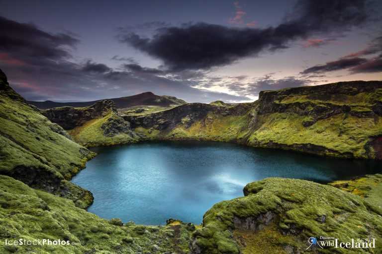
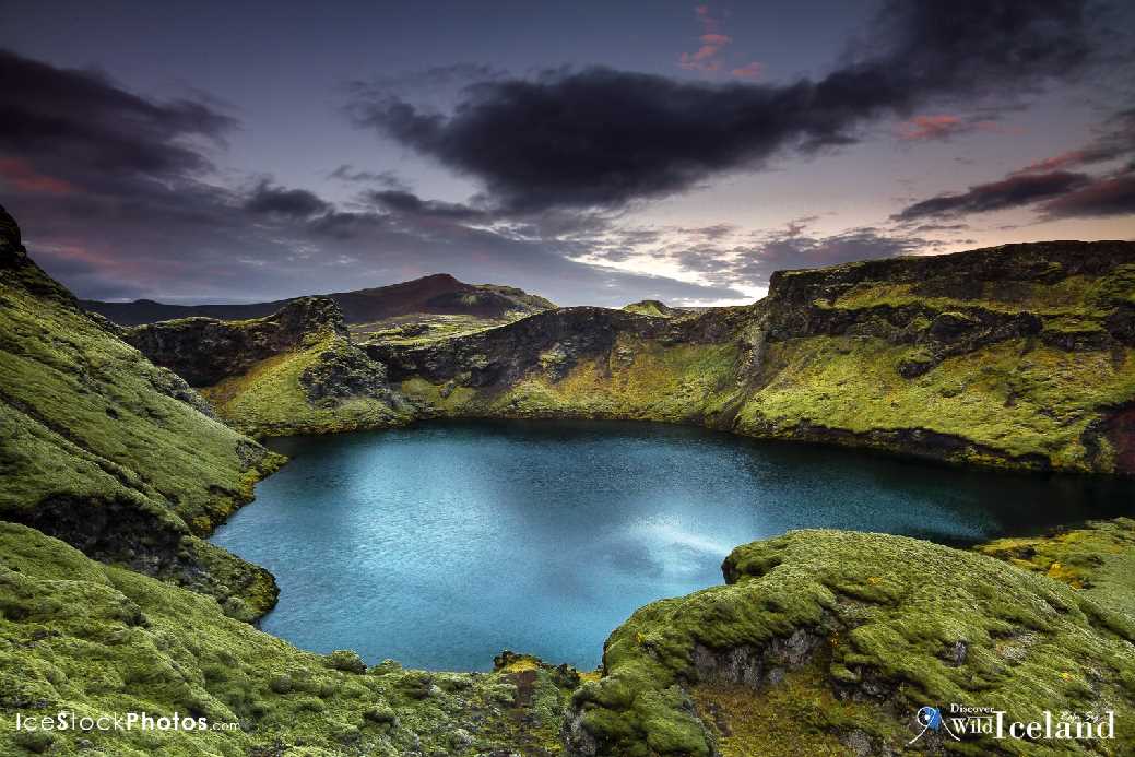
没有什么可以比拟冰岛高地的荒芜、原始及苍茫的美丽。在这片区域,少有人烟、没有城市、没有村庄,有的只是望不尽的平原、冰川、河流、覆盖着冰盖的熔岩原、火山口和怪石嶙峋的山脉。但正是这份孤独苍劲,吸引了游人的目光,涉足于此的旅人无不为高地所折服。自然,让人类学会谦卑。

Gjallandi waterfall in river Skjalfandafljot. Highlands of Iceland.
Skjalfandafljot河的Gjallandi瀑布。摄于冰岛高地
Laki or Lakagígar (Craters of Laki) is a volcanic fissure in the south highlands of Iceland,. Lakagígar is the correct name, as Laki mountain itself did not erupt, as fissures opened up on each side of it. Lakagígar is part of a volcanic system centered on the Grímsvötn volcano and including the Þórðarhyrna volcano. It lies between the glaciers of Mýrdalsjökull and Vatnajökull, in an area of fissures that run in a southwest to northeast direction.
拉基火山口(Laki或 Lakagígar)是冰岛南部高地的火山裂缝。 Lakagígar这一名字其实更为准确,因为拉基山(Laki)本身并没有发生火山爆发,而山两边却出现了裂缝。拉基属于中心位于格里姆火山(Grímsvötn)的火山系统,这个系统也包括Þórðarhyrna火山。火山处于米尔达斯冰川和瓦特纳冰川之间,也在西南至东北走向的裂缝带之间。

过去,人们在夏季利用高地上的山径作为来往于冰岛南北两端的捷径,也有传说称,幽灵鬼怪在这里吓唬旅人。如今,不担心鬼神而担心多变的天气似乎更加明智,因为高地上的自然条件变化多端,即使在仲夏时节也可能会下雪。不论是开车、骑自行车或者徒步旅行都需要非常谨慎并且将行程告知联系人。高地上没有铺平的路面,有的只是前人留下的小径,河流上也少有桥梁。其实能够贯穿南北两端的路只有两条,分别是Sprengisandur (F26) 和 Kjölur (F35)。这份孤独隔绝,让旅人深醉其中。除了自由行,也可以参加巴士旅行团,安全无忧欣赏高地风景。冰岛高地地貌宛如外星,难怪当年阿姆斯特朗也选择在这里作登月训练。
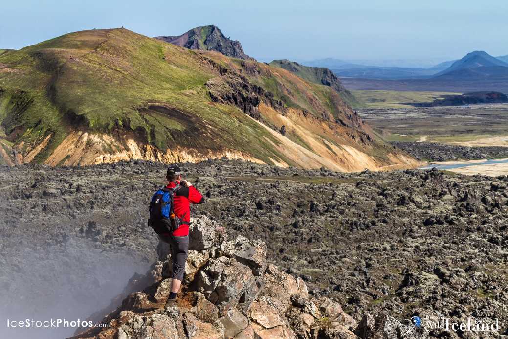
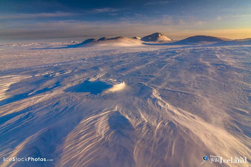
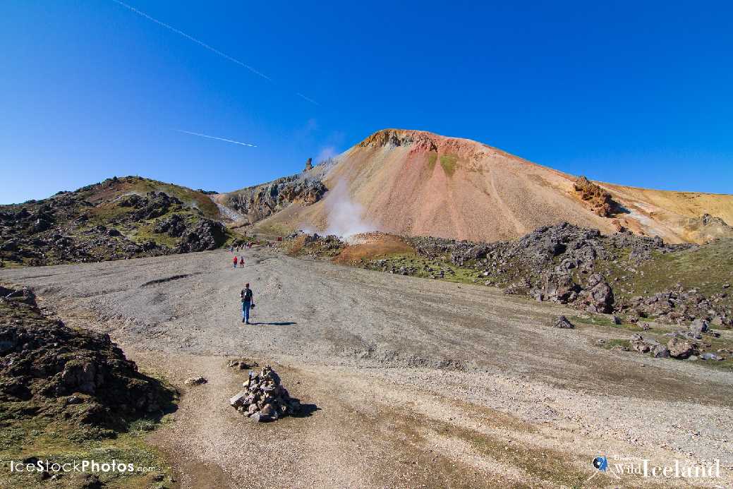
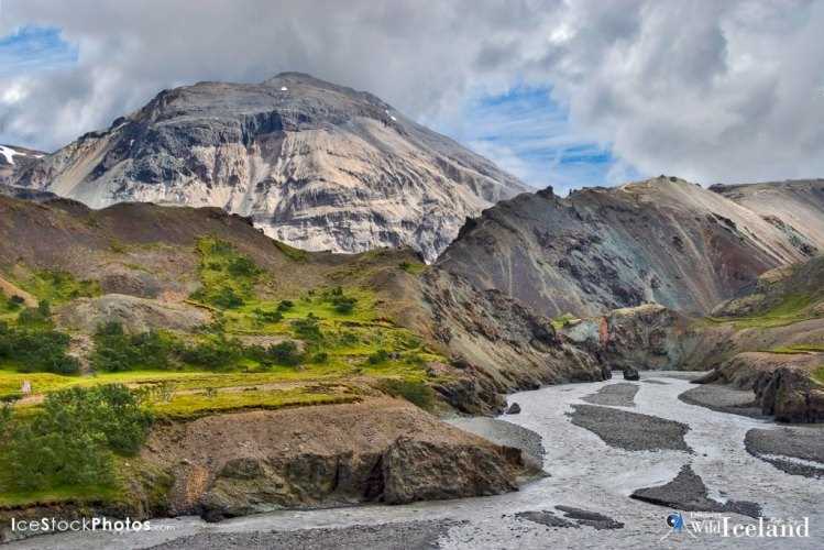
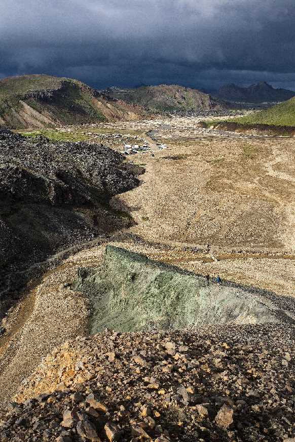
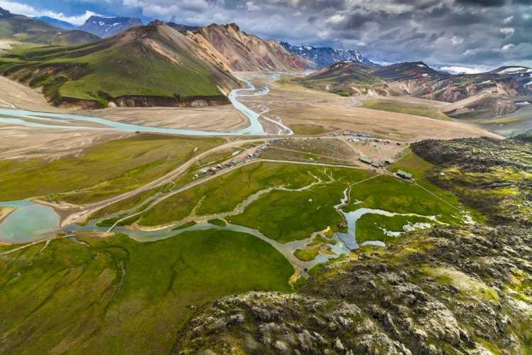
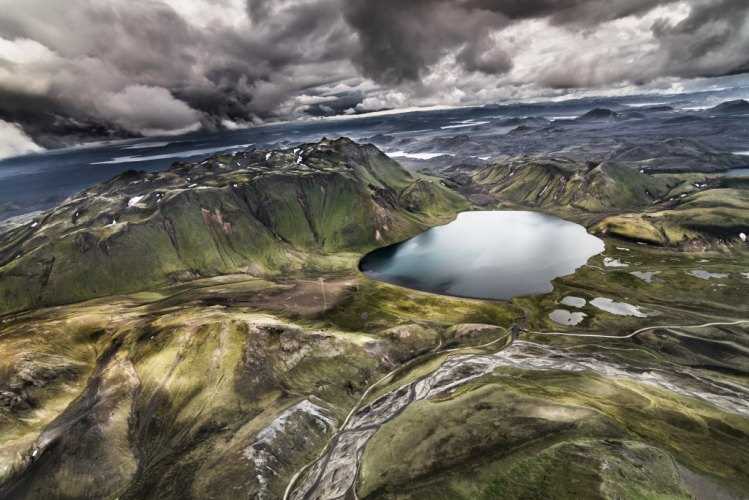
Back packers walking in the Highland’s of Landmannalaugar towards Brennisteinsalda, Iceland
背包客面向Brennisteinsalda火山方向,行走在兰德曼纳劳卡高地上。
Sprengisandur, Highlands of Iceland
Sprengisandur高地
Back packers walking in the Highland’s of Landmannalaugar towards Brennisteinsalda, Iceland
背包客面向Brennisteinsalda火山方向,行走在兰德曼纳劳卡高地上。
The falls plunge 33 feet in a horseshoe-shaped recess, breaking into as many as six distinct segments depending on how much water is present in the artificially reduced river. During periods of heavier discharge the whole ledge may become covered in water, stretching out to nearly 200 unbroken feet in width
瀑布从33英尺(约10米)的空中倾泻而下,注入地面马蹄状的凹槽,水流分成6股,流入经人工减流的河中。在排量较大时期,整个壁架充满水,一直扩至200英尺宽(约60米)。
Breiðamerkurjökull is part of the big Glacier Vatnajkull
Breiðamerkurjökull冰川是瓦特纳冰川的分支。
Glacier Sólheimajökull - Iceland
冰岛索尔黑马冰川
Lónsöræfi ( Lonsoraefi ) in the East highlands of Iceland
冰岛高地东部的Lónsöræfi野外
Taken in south-Iceland
摄入冰岛南部
Landmannalaugar is a region near the volcano Hekla in southern section of Iceland's highlands
兰德曼纳劳卡靠近冰岛南部高地的赫克拉火山(Hekla)。
Landmannalaugar area - Highland - Iceland
Landmannalaugar area – Highland – Iceland

Photo: Rafn Sig