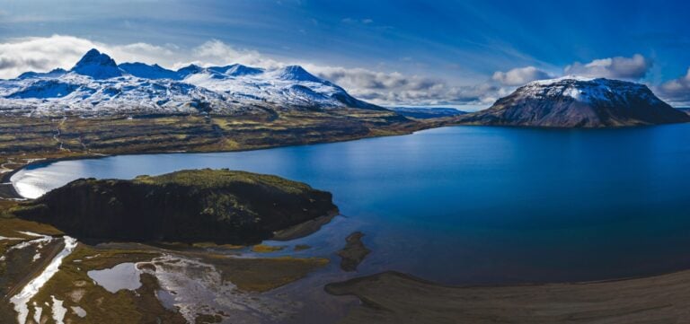
Hvalavatn at the end of Hvalfjörður, is a gorgeous lake, as are its surroundings. Hvalvatn is the second deepest lake in Iceland and covers a 4.1 km² area. It is 180 meters deep at its deepest and lies at 378 meters above sea level. The road from Uxahryggjavegur to the lake is difficult to cross and cannot be driven in smaller jeeps. Mt. Hvalfell is in front of the lake in the picture, surrounded by a spectacular and beautiful environment. The mountain that rises on the south side up from the lake is Botnssúlur. Botnsá River flows from Hvalvatn Lake to the sea in Hvalfjörður fjord. There are two species of trout in the lake and one of them can become huge. Trout up to 12 pounds in size have been heard of, but the other char species are considerably smaller. Botnssúlur are popular for hikers; there is a cluster of tuff peaks called Háasúla, Miðsúla, Norðursúla, Syðstasúla (1093m) and Vestursúla. They have in common that they are all located between Botnsdalur Valley in Hvalfjörður and Þingvellir National Park. The route between Þingvellir and Botnsdalur is called Leggjabrjótur, and it is a famous hiking trail. Photo Steini Píp.