


Municipalities and Main Towns
Hveragerðisbær
Great numbers of people pass through or by Hveragerði each year. With a population of about 2300 and located only 45 km from Reykjavik, Hveragerði may be viewed from the vantage point of the Kambar mountain slope, as it spreads out across a 5000 year-old lava field. Throughout the year, pillars of steam may be seen rising up from the town – and in summer it is truly a green community, abounding in trees. A green revolution is taking place as areas of woodland in and around Hveragerði expand, with the locals working together in order to further develop their blossoming town.
Certainly the most precious gem of the town of Hveragerði is its geothermal area – surely there are not many communities in the world with hot springs literally in their back yard. For safety reasons, the geothermal area is securely fenced off, but may be visited by arrangement with the tourist information centre.
A new hot spring area emerged from the ground in the earthquake that shook Iceland´s southern part on 29th May 2008. It is situated on the hillside rising above the town.
Several very active hot springs throw colourful mud and clear water up into the air and are a spectactular sight.
Besides the hot springs, Hveragerði has much to offer. Trout and salmon swim in the Varmá river, berries are for the picking on the heath to the west of the town, and the area abounds in excellent walking routes. Not to mention the swimming pool, hot baths, whirlpools, a natural sauna and a fitness centre. Also the NLFÍ Health and Rehabilitation Clinic offers opportunities to seek health and happiness.
Þorlákshöfn – Ölfus
The main town in Ölfus is Þorlákshöfn, west of Eyrarbakki. The town is important as a port because the only viable harbour on Iceland’s southern coast between Grindavík in the west and Höfn in the east is situated there. The town has a population of about 1500 people.
The industrial foundations in Þorlákshöfn are ship-outfitting and fish processing factories, with business and service industries growing fast. Leisure opportunities for tourists are excellent, with an outdoor swimming pool with hot baths, a steam bath and a brand new waterslide. A good campsite is next door to the pool, with indoor cooking facilities and spaces for mobile homes. From the swimming pool you can select many walking routes in the surrounding area and longer walks along the coast, leading all the way to Selvogur and Herdísarvík, and along the beach leading to Óseyrarbrú and Eyrarbakki. In the Egilsbúð library and museum items that tell the story of the development of the town are to be found.
The town church in Þorlákshöfn is built in a unique style, and Strandarkirkja church in Engilsvík in Selvogur is famous as a place for vows. Anyone wishing to go caving has the Raufarhólshellir caves, which are some 1360 metres long. Duggan in Thorlákshöfn and Skíðaskálinn in Hveradalir offer many services to travellers, among them food and drink. Many scenes in the epic blockbuster movie “Flags of our Fathers” (directed by Clint Eastwood and produced by Steven Spielberg – 2005) were filmed on the black beaches close to Þorlákshöfn. There are also plans to construct a big international golf course close to Þorlákshöfn.
 Vestmannaeyjabær
There are places in Iceland that simply need to be experienced. Vestmannaeyjar (the Westman Islands) are fill that group by virtue of their natural beauty, the bounty of their wildlife, particularly birds, and by being historically and geographically one of Iceland´s most distinctive places. The islands are part of a young and still active submarine volcanic system, most of them coming into being 10-20.0000 years ago. The latest in the group, however, Surtsey, south of Heimaey, grew from the sea floor in episodic eruptions from 1963 to 1966.
 The famous eruption on Heimaey, the largest and the only inhabited island was, however, even more spectacular. It began in January 1973 and lasted until early July. The cone Eldfell rose, the island became 2,3 km2 larger and block lava flows and ash burned or buried almost 400 buildings. The remains of the eruption are among the island´s most fascinating historical locales.
A journey to the Westman Islands is neither more expensive nor difficult than to many mainland places. The only difference is in the preparation as prior booking either by sea or air is advisable. From Reykjavík the trip by air is only 20 minutes, from Bakki in Landeyjar a mere 6 minutes. The passenger and car ferry Herjólfur makes the trip from Þorlákshöfn in 2.45 hours, offering the obvious advantage of a relaxing sea voyage and your vehicle on hand on arrival. Heimaey may only be about 13 km2, but that small area contains enough magical scenery and birdlife to delight the visitor for days. There have always been visitors to the islands, but as an industry tourism is recent. It is even possible to put a date to its birth: 1973 after the eruption, when visitors from all over the world came to view the aftermath and remains of the catastrophe. Thirty years later, Eldfell, the new cone, and the cooled and hardened lava flows, have become part of a magnificent environment. Other popular attractions are one of Iceland´s best 18 hole golf courses, deep sea fishing, bird- and whale-watching and hiking: up volcanoes, over lava fields or along the shore. Museums tell the history of the two- and four-legged inhabitants of the land as well as those of the air and the sea through the centuries. Comfortable accommodation is available as well as first class restaurants and coffee houses. A short daytrip, as the only option of visiting us, is therefore very much a thing of the past. The islands’ tourism industry endeavours to make visitors feel welcome and preferably wish to prolong their stay.
Selfoss – Árborg
With a population of over 4000 inhabitants Selfoss is the largest town in South Iceland and is a part of Árborg Municipality which was established in 1998. It also includes the villages Eyrarbakki and Stokkseyri. The distance from Reykjavík is 57 km. In addition to the Ring Road, Iceland’s main highway, which runs east and west through the town, roads lead from Selfoss in all directions, north to the Golden Circle / Keldur route and south to Stokkseyri / Eyrarbakki / the Reykjanes peninsula.
The town is an excellent centre for day tours to the many places of interest in the area. Some salmon is caught downriver from the Ölfusá bridge. All necessary services for tourists (including a hospital, pharmacies, banks, a shopping centre, restaurants, hotels, a golf course, a cinema, horse farms, an airport and much more) are available in Selfoss.
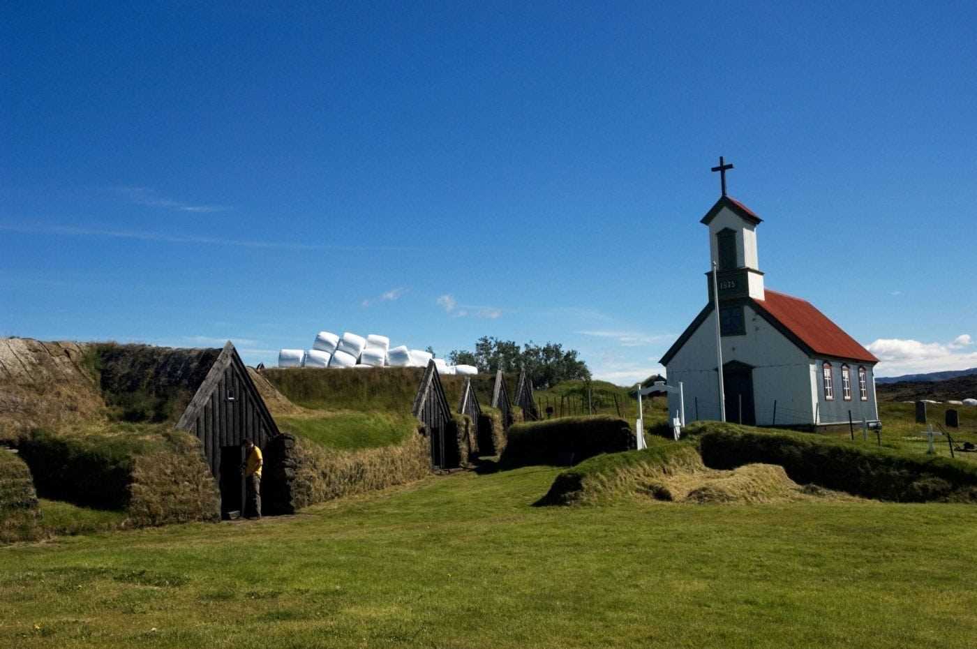
 Eyrarbakki – Árborg
The friendly village of Eyrarbakki used to be the largest commercial community and the main harbour on the south coast of Iceland in earlier times. A large number of preserved houses from the period 1890-1920 are situated in Eyrarbakki and therefore a visit is like reverting a 100 years back in time. Other popular tourist attractions are The Eyrarbakki Maritime Museum and the Árnessýsla Folk Museum, located at the legendary “The House” in Eyrarbakki, built in 1765. In Eyrarbakki there is also a fine camping site, a guesthouse and a restaurant. On the rocky shore you can witness an amazing view of the Atlantic Ocean, as well as watch the surf break. It is an ideal spot for hiking and bird-watching. The Flói Bird Reserve lies northwest of Eyrarbakki and is an important nesting area.
Stokkseyri – Árborg
The small village of Stokkseyri is renowned for its beautiful seashore, breaking waves and birdlife. Rich handicraft and cultural life is held in high esteem in Stokkseyri. Workshops and galleries, a Ghost Center and the Elves, Trolls and Northern Lights Museum are all situated in a Cultural Centre – an old fish processing factory that has found a new role due to changes in the fishing industry. The Hunting Museum keeps a large collection of mounted animals and firearms and the bunkhouse Þuríðarbúð shows an excellent example of how fishermen had to make use of what nature provided. Stokkseyri also offers a splendid seafood restaurant, an outdoor swimming pool, kayak sailing tours, a family recreation park with animals and a camping site. Further east from Stokkseyri there is the Knarrarósviti lighthouse, whose architectural design is an interesting blend of functionalism and art nouveau.
Flóahreppur
Flóahreppur provides peaceful environment, historic areas and beautiful nature to the east of Selfoss. Agriculture is the main livelihood along with increasing tourism services. The cultural foundation of the area has deep roots in history and includes many people of skill and trade. The community offers many occasions for social gatherings, for example by the women’s council and a youth organization. The great waterfall Urridafoss is located in Flóahreppur in the mighty Þjórsá river as well as the greatest lava flow on Earth since the last ice age: The Þjórsá lava field. The scenery is exceptionally wide, a range of mountains, glaciers and islands. One of the Icelandic sagas, Flóamanna saga, preserves accounts about this area which is also a paradise for naturalists and bird-watchers.
Inland Árnessýsla
One of Iceland’s most popular tourist areas, inland Árnessýsla boasts a wealth of natural wonders and well-marked historical sites. Hot springs and geothermal heat characterise the region and make their impact on the culture of the area, as well as on the historical sites marking milestones in the history of the country and society of Iceland. The inlands in Árnessýsla stretch from Þingvellir to the Þjórsá river and into the central highlands. The inhabitants are abut 2600 and live in four municipalities: Bláskógabyggð, Grímsnes- og Grafningshreppur, Hrunamannahreppur and Skeiða- og Gnúpverjahreppur.
Laugarvatn – Bláskógabyggð
Laugarvatn is a shallow lake, about 2 km2 in size, and is located in the inlands of Árnessýsla, midway between Þingvellir, Gullfoss and Geysir, 100 km from Reykjavík. Under its floor there are hot springs heating the lake so it is warm and suitable for bathing all year round. On its bank rests a village of over 300 inhabitants, also named Laugarvatn.
The Laugarvatnsfjall mountain with its birch-covered slopes on the west shelters the village and also adds to the charm and beauty of the place. Between the mountain and the lake, north of the village, there is a panoramic point (hringsjá) providing a good view over the lake and its surroundings. In addition, amongst the green hills and woods north of the lake the area is suitable for camping, pony-trekking and hiking. Nearby you will find a lot of marked hiking routes.
It is possible to hire a boat or a sailboard to use at lake Laugarvatn. Just outside Laugarvatn there is a golf course and possibilities of angling in lakes and rivers in the area. Laugarvatn is a popular tourist resort for Icelanders, and it is also the site of educational institutions, as for example the Grammar School of Laugarvatn. There are two Edda Hotels located there as well.

Flúðir – Hrunamannahreppur
Flúðir is a rapidly growing community in the centre of Hrunamannahreppur district, about 25 minutes off the main Ring Road. The area is considered to be very fertile and beautiful. Litla-Laxá, a clear spring river runs through the village in an attractive basin. Miðfell, a small mountain, towers over Flúðir, and gives the surrounding area a distinctive look. Good walking and riding paths lie to the top of Miðfell. Up there you will find an impressive lake and from the top there is a great view over the area.
The main sources of employment in Flúðir are services, industry and horticulture. Geothermal heat is utilised for greenhouses, and here is the biggest mushroom factory in Iceland. The surrounding area is a popular location for summerhouses. Flúðir has excellent services available for visitors. Among those are a grocery store, a restaurant, a swimming pool, accommodation in the three star Icelandair Hotel Flúðir, a camping ground, an information centre, a golf course, a horse rental, a bank, a post office and a small airfield. A folk museum is at the farm Gröf.
 Ásahreppur
Ásahreppur is a community on the western edge of Rangárvallasýsla and takes its name from “the ásar”, natural ridges in the area. On the Ring Road the community has its limits from the bridge of Þjórsá river in the west and to the east the boundary is about 500 m from Landvegamót. There has been a bridge across Þjórsá since 1895. Ásahreppur has about 170 inhabitants who have agriculture and service as their main employment. The nature varies between grassy swamps, reclaimable land, farm areas, hills and ridges. The biggest nesting place of the grey lag goose is in the swampy desolated area of Frakkavatn. The structure of habitation is mostly clusters of farms around the ridges, Vetleifsholtscluster, Áscluster, Ásmundarstaðircluster, Hamracluster, Sumaliðabæjarcluster, and Kálfholtscluster. In the area of Ásahreppur there are many artificial caves, used as animal houses up to the 20th century, but in the first centuries after the settlement of Iclenad it is said they were used for human habitation. Schools and other basic service for the inhabitants of Ásahreppur are kept up in good co-operation with their neighbouring communitys in Rangárvallasýsla, Skaftárhreppur and Mýrdalshreppur.

Hella – Rangárþing ytra
Inhabitants in western Rangárþing (Rangárþing ytra) are about 1600. The borders of the district lie from Ásahreppur district, from Þjórsá river in the west to Vatnajökull glacier in the north. The south border lies from the Mýrdalsjökull glacier to Eystri-Rangá river. In Rangárþing ytra agriculture flourishes. In the area you can find many well-known nature resources and historical places, for example the mountain of Hekla, Landmannalaugar and the saga-trail of Njáls saga. The town of Hella is the biggest residential area with about 800 inhabitants. Hella’s inhabitants are primarily occupied with services for the agriculture, their surrounding areas and the tourism industry. At Hella there is a bank, a post office, a tourist information centre, a hotel, guesthouses, camping sites, restaurants, shops, a pharmacy, a healthcare centre, a sports centre, a swimming pool, car services, a rescue team, gas stations and other businesses and public services.

Hvolsvöllur – Rangárþing eystra
Inhabitants in eastern Rangárþing (Rangárþing eystra) are about 1750. The borders of the district lie from western Rangárþing to the north and the west. The border to the east lies through the glacier Mýrdalsjökull and to the south by the river Jökulsá á Sólheimasandi.
The district’s most densely populated area is the town Hvolsvöllur with about 800 inhabitants. Hvolsvöllur’s primary businesses are services for the agriculture, their surrounding areas and the tourism industry. At Hvolsvöllur there is a bank, a post office, a tourist information centre, a hotel, guesthouses, camping sites, restaurants, shops, a pharmacy, a healthcare centre, a sports centre, a swimming pool, car services, a rescue team, gas stations and other businesses and public services.

Vík – Mýrdalshreppur
Vík is Iceland’s most southerly village. Although this community of about 600 inhabitants faces the open Atlantic, Vík is the only seaside settlement in Iceland left without a harbour due to natural circumstances. Nevertheless, Vík’s inhabitants go fishing with the help of their amphibious boats, which enable them to drive, literally, out to sea. The average precipitation in Vík is the highest in the whole of Iceland – which of course means that there is a lot of rain, snow, wind, sleet, hail and fog here. This is, however, not always the case as the weather here changes very rapidly, the sun comes back out, and therefore rainbows are probably more frequent and vivid here than anywhere else.
The natural beauty of the area is spectacular. There are many places of interest in the vicinity of Vík. Just east of the outskirts of the village lies one of Europe’s biggest arctic tern breeding grounds. South of Vík there is a beautiful beach, which the international ISLANDS Magazine named one of the world’s ten best island beaches in 1991. A short hike within the close vicinity of Vík is sure to satisfy all serious nature lovers and bird-watchers. To the south of Reynisfjall mountain a spectacular set of rock columns called Reynisdrangar rise majestically out of the Atlantic Ocean.
Dyrhólaey, where the unique rock arch is found, is a 120 m high promontory in the western part of the Mýrdalur district. Dyrhólaey is Iceland’s most southerly tip. North of Vík rises the bulk of the 700 km2 Mýrdalsjökull glacier, Iceland’s fourth largest. Approximately 600 metres below the ice lies the dormant sub-glacial volcano Katla. Katla is one of Iceland’s most active volcanoes, and has on average erupted twice a century, the last occasion being in 1918.
Vík has good travel services and offers plenty of camping and hotel space ( Edda Hotel ). Among the many aspects of Vík that make it attractive to tourists are the increasingly popular sea-and-land trips in boats, sight-seeing flights; snowmobile trips, ice-climbing and dogsledding on Mýrdalsjökull glacier; excellent salmon and trout fishing; horseback riding, a wool center and a fish farm / retail outlet of smoked salmon, to list but a few. Not many other places in Iceland offer as many contrasts of nature as Mýrdalur. The area is therefore an ideal place to visit for travellers who want to enjoy good service and the best of what the country’s natural environment has to offer.
Skaftárhreppur
If you want something different it is ideal to visit Skaftárhreppur, where 100 km2 is shared by only 7 people. We offer you our services on local farms and in the village of Kirkjubæjarklaustur.
Here you will find some of Iceland´s natural treasures, Eldgjá, Langisjór and Lakagígar, to name only a few.
It is an area where earth and people have been shaped by fire, wind and water.
Skaftárhreppur is a gateway to the southeast and a part of Vatnajökull National Park.

Kirkjubæjarklaustur was known in olden times as “Kirkjubær” (Church Farm) and was an important farming estate. It is one of the most tongue-twisting words to pronounce of any location in Iceland. Kirkjubæjarklaustur has developed into a village, the only centre of population in the district, with about 150 inhabitants. Kirkjubæjarklaustur, often abbreviated to “Klaustur”, is centrally located in the district. Roads radiate from Klaustur in many different directions and the Ring Road runs through the district. The Laki road, just west of Kirkjubæjarklaustur, leads into the highlands. The circular Landbrot / Meðalland road serves the southern part of the district. The Fjallabak roads (north and south) lead from the Ring Road into the interior via Skaftártunga. The Álftaver road is a circular route serving Álftaver on Mýrdalssandur.
Kirkjubæjarklaustur is the only place between Vík and Höfn which offers services, including a fuel station, a bank, a post office and a supermarket. Nearby tourist attractions include the Laki craters, the Eldgjá and Skaftafell National Park. An attraction close to the village is Kirkjugólf (Church Floor), a natural pavement of basalt. These are basalt columns down in the earth, eroded and shaped by wind and waves, but only the top can be seen, and they, as the name suggests, have the appearance of a paved church floor. It is a protected natural monument. This lava formation has similar origins as the Giant’s Causeway in Ireland. All these attractions contribute to the popularity of Kirkjubæjarklaustur as a stopping point for tourists.

VATNAJÖKULL REGION, THE CLUSTER
Vatnajökull Region ehf., is a group of companies formed with the support of the South East Innovation Centre. It incorporates not only travel companies but also cultural and food processing enterprises.
Our goal is to entwine the operations of the 80 different companies who are part of this project. The region as a whole is marketed under one brand whose logo is WOW with emphasis on locally produced agricultural goods, culinary souvenirs that can be traced directly to the region, handicrafts and other exceptional things.
In this region, like in other areas of Iceland, many farmers have abandoned traditional farming in favour of earning a living from travel services, although many still farm their lands and also welcome tourists with bed and breakfast accommodation. The emphasis in marketing is the wintertime.
The inhabitants of the region do not only live in proximity to the Vatnajökull glacier but also to the sea. The region is therefore known to be one of the finest places for seafood – especially for the Icelandic langoustine – as fishing has always been an important industry in Hornafjörður. In addition to its famous and healthy cuisine, the clean and unspoiled nature is a hallmark of the Vatnajökull region. Here in the realm of Vatnajökull National Park and the biggest glacier in the world outside the arctics, we believe that there is no boundary to what we can achieve if we work together.

Höfn – Hornafjörður
Hornafjörður is a blooming community close to the biggest glacier in Europe, Vatnajökull in the south eastern part of Iceland. The district’s most densely populated area is Höfn. In this region you are located at the base of Vatnajökull, and the scenery is breathtaking. Skaftafell National Park, the largest national park in Europe, is situated in the community. In the last few decades tourism has grown enormously and has, in fact, become a major economic sector in the community. Diverse services are provided, including hotels, camping sites, restaurants, shops, swimming pools, golf courses, marked hiking trails and various museums, such as a folk museum, a maritime museum, a glacier exchibition and the centre of the great writer Þórbergur Þórðarson.
Höfn’s growth in the 20th century from a small village to today’s town was a result of the development of a relatively diverse fishing industry. The landed catch is now more varied than in other fishing towns, including high-value species such as the Norway lobster (Nephrops norvegicus), but a good part of the Icelandic lobster catch is landed at Höfn. In recent years the town has promoted lobster as a central part of its image, for instance with a “lobster festival” that is held each summer. Höfn actually means harbour, though repeated dredging has proved necessary to keep the entrance of the harbour safe from sand deposits.

