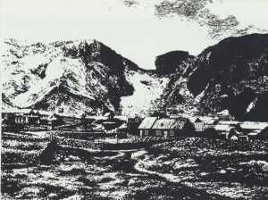
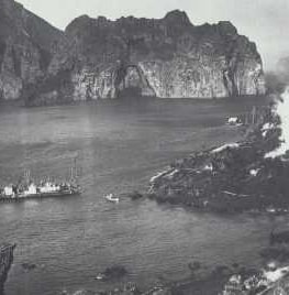
The two most momentous events in the history of Vestmannaeyjar are the Turkish raid in 1627, and the Heimaey eruption in 1973. Both events resulted in a great disturbance of all life and activity of the island inhabitants. The eruption in 1973 is now often spoken of as a turning point, events are said to have occurred before or after the eruption. The picture above shows a view from Elliðaey to Heimaey before the eruption. At left is the volcanic cone Helgafell which is about 5000 years old.
Between it and the beach in front are fields above Urðir where the fissure opened on the morning of January 23,1973. One can see the area around Kirkjubær and the part of the town which later disappeared under lava and ash. At right is Ystiklettur. The picture at left is a view of the town of Vestmannaeyjar after the eruption. The picture was taken August 5, 1978, from Klifið. In the foreground is the harbour, then the town, which has now been cleared of the volcanic ash which covered it. Beside the old Helgafell, a new neighbour has risen, the volcano Eldfell, lava from which has engulfed part of the town. Normal life is back in full swing however, and Herjólfur, the ferry between the mainland and the island is coming into the harbour. At this point, a short survey of the history of Vestmannaeyjar before the eruption is interesting. 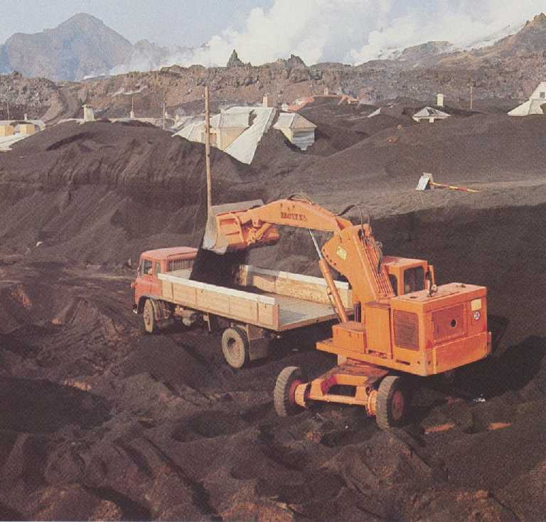 Vestmannaeyjar began to figure in Icelandic history immediately after the settlement. There is a well- known story in Landnámahók about how slaves belonging to Hjörleifur, foster brother of Ingólfur Arnarson fled to the island, probably about 875. They were pursued there by Ingólfur Arnarson and his men and killed. The islands have since been called Vestmannaeyjar, ‘Westman Islands,’ because the slaves were ‘Westmen,’ i.e. from Ireland. Scholars do not believe this story to be true. Just as likely is the theory that the name of the islands comes from ‘Westmen,’ Nordic men who had lived in Ireland, who were the first to settle permanently there. This could have been Herjólfur Bárðarson, who is said to have taken land in Vestmannaeyjar about 900. It is certain that Vestmannaeyjar, i.e. Heimaey, have been inhabited ever since late in the first century of settlement.
Little is known about the first centuries of human habitation in Vestmannaeyjar, but it is said that before Herjólfur Bárðarson built his home there, farmers from the southern areas of the mainland had winter quarters on Heimaey, which was their base for fishing operations. Vestmannaeyjar was owned by farmers until sometime in the 12th century, when Magnus Einarsson, bishop of Skálholt, bought them with the intention of founding a monastery there. Nothing came of this plan, but the islands remained the property of the Skálholt see until they became crown property about 1500. In the 15th century, the English began fishing off Iceland and trading there, and Vestmannaeyjar became one of their main bases until about the middle of the 16th century. One of the saddest events in the history of Vestmannaeyjar was the so-called ‘Turkish raid’ in 1627. The culprits were not Turkish, however, but rather pirates from Morocco. They attacked the island with a force of 300, killing 36 of the inhabitants and kidnapping 242 men, women and children, whom they subsequently sold into slavery. The ‘Turks’ killed one priest, Jón ‘the Martyr’ Þorsteinsson, and took the other with them to sell as a slave. The few dozen inhabitants who remained behind had escaped by fleeing into the caves and other hiding places in the cliffs. A long, difficult period for the Vestmannaeyjar followed this event.
There was extreme poverty in spite of the rich fishing grounds nearby, and the plentiful sea birds in the cliffs. The situation began to improve when new and improved ships and fishing equipment were introduced. When boats with engines superseded rowboats about 1905, catches increased, profits grew, and the population began to increase as well. With increased fishing and salt fish production, various industries connected with fishing began to grow as well. There were harbour improvements to accommodate the larger fishing fleet. The depression years around 1930 were very difficult for many, however. At the beginning of the last world war, the price for fish rose, the salting of fish was discontinued, iced fish was exported and freezing fish began. Vestmannaeyjar became a separate administrative unit (sýsla) in 1609. In 1787, the town was granted municipal rights, but they were withdrawn in 1807. Vestmannaeyjar again became a municipality in 1918, when the population numbered 2000. There were 5200 inhabitants, and economic life was flourishing when the earth split open and the eruption began on the night before January 23, 1973.
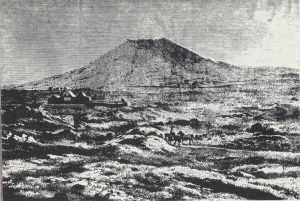
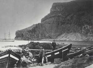
Above is a drawing which the Danish artist, Carl Baagöe made of Helgafell in the Vestmannaeyjar probably in 1878. Heimaey was not densely populated at that time. The picture below is from the turn of the century. Hrófin is the name of the landing place were rowboats were drawn shore, and Nausthamar is the name of a rocky point out near Hrófin. Farthest left on the picture is the eight-oared boat Gideon. In the background is Eiðið and Heimaklettur.
This drawing below by Carl Baagöe of the trading centre Heimaey is probably from 1878. The picture shows the western part of the town near the harbour with Klifvi in the background. The long house on the right in the middle of the picture is ‘Frydendal’ or Vertshúsið as it was called after 1850. A Danish woman, Ane Johanne Ericksen ran a restaurant there. Her husband had drowned on a shark-fishing expedition in 1847. She later married C.V. Roed and was then known as Madame Roed. She was a pioneer horticulturist and taught islanders how to grow potatoes among other things.
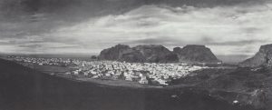
Above is a panoramic view of Heimaey after the eruption. The picture was taken from the slopes of Eldfell, the new volcano, just above the memorial stone to the Reverend Jón ‘the Martyr’Þorsteinsson. Here the town of Vestmannaeyjar has mostly risen from the ashes after the clean-up operations. However, part of the town disappeared under the lava which is visible in the centre of the picture. Behind the town, in the centre, is Herjólfsdalur, a short valley which cuts into Dalfjall. Herjólfsdalur is actually a 10,000-year-old volcanic crater which the sea has partly broken down. Up near Friðarhöfn, farthest into the harbour of Vestmannaeyjar, is Klifið. Between this and Heimaklettur is Eiðið. Out off Heimaklettur and Miðklettur is Ystiklettur, and between them is Vikin. All the way from the mouth of the old harbour out to the right edge of the picture is the new lava from Eldfell. In the background is a view to the mainland, and Elliðaey and Bjarnarey are farthest to the right.
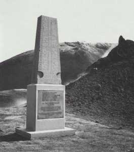
In the middle of the picture above and on the picture at left is the memorial stone to the Reverend Jón Þorsteinsson, ‘the Martyr’, who was killed by pirates on July 17, 1627. In the summer of 1924, when someone was digging in a vegetable garden in Kirkjubser where there had formerly been a chapel, a stone with lettering carved on it was discovered. An exact copy of this stone was made as a memorial to the Reverend Jón the Martyr and raised at Kirkjubaer in Vestmannaeyjar where Jón had been priest and where the original stone had been found. When the lava flow approached Kirkjubaer, the stone was removed. It was subsequently raised on a new base in the lava from Eldfell above the spot where it had stood before, now however, higher by the thickness of the lava layer.
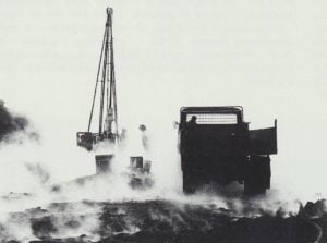
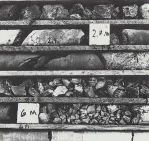
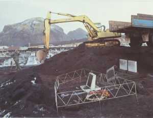
Below are pictures from the core-drilling in the new lava from the volcano Eldfell, during the eruption. The drilling tower is to the left, and a box with cores from the drillings at right. By drilling through the lava it was possible to judge the effect of the mechanical sea-cooling on the solidification of the floating lava. It was found that the lava was still glowing at a rather limited depth from the surface, but there was considerable difference between the solidification at areas where sea water had been pumped onto the lava to cool it, and areas where no such cooling had taken place. Roads were built on top of the still floating lava with bulldozers, to enable lorries to be used for transporting equipment. These roads had however to be repaired and rebuilt continuously, as the lava was still moving. Volcanic ash was used as top layer on the roads, to insulate the surface somewhat from the enormous heat of the molten lava-masses below.
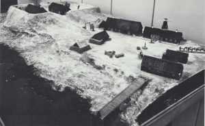
After the eruption, an attractive museum and library building was built in Vestmannaeyjar. It houses the library, an art museum and the remarkable district museum. The founder of this collection is Porsteinn Þ. Viglundsson, former schoolmaster of the elementary school and director of a savings bank in the Vestmannaeyjar. He began collecting relics about 1932, and he continued this work for 46 years. These objects have now found an appropriate exhibition site in the new building on Stakkagerðistún. The exhibition rooms of the District Museum of Vestmannaeyjar – one of which is shown in the picture at right – were dedicated on April 15, 1978. Above is a picture of a model of Skansinn in Vestmannaeyjar as it was in 1844. The fort is at left and the merchants’ stores at right. In the 15th century and into the 16th, the English fished and traded in Vestmannaeyjar. In 1552, the Danish trade monopoly was imposed on Vestmannaeyjar, and a 50-year period of constant strife with the English began. In the spring of 1586, the Danish monarchy sent a company of troops from the Danish army to Vestmannaeyjar to build fortifications around the entrance to the harbour and to set up 6 cannons there to counter the English attempts to trade and have a land base for fishing. The fort was of no use during the ‘Turkish raid’ as the pirates landed first on the south side of Heimaey. The fort was rebuilt in 1630—38. – Below is a gun from the ‘Turkish raid’ which was found in Vestmannaeyjar harbour. North African pirate ships used guns like this.
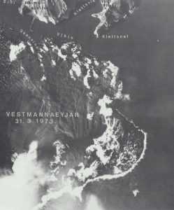
Above is an aerial photo taken by Landmælingar Islands (Icelandic Survey Department) on March 31, 1973, of the new lava which came from Eldfell on Heimaey. A few place-names are marked, such as Skansinn where the fort formerly stood (see p. 384). The site is now mostly engulfed by lava. On the picture, many houses in Vestmannaeyjar are still buried under ash. They were later dug out and re-built. Efforts to cool the lava prevented the entrance to the harbour from being sealed off, and the harbour is now actually better than it was before, as there is now a long fjord outside the mouth of the harbour at a place where there could be powerful breakers before.
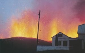
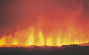
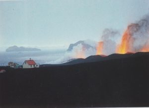
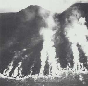
The eruption on the east side of Heimaey Which began at 1:55 on the eve of 23 January 1973 came as a surprise and completely without warning. People had actually noticed vaeu earth tremors on Heimaey from 10 pm the evening before, but sharp tremors did not come before 1:40, just before the eruption began Then the earth opened just 200 m from Kirkjubaer, the easternmost part of the town on Heimaey. Witnesses in these houses said the beginning was most like a fire in dry grass when fire was first seen in a small area of the field. The earth’s crust then split in both directions from this spot and soon a 1600-m long eruption fissure had opened, stretching from the end of the landingstrip on the middle of the higher part of the island and north through JJrdir and out into the sea in the direction of the harbour at Yztiklettur. Never before in the history of the settlement of Iceland had an eruption begun so close to a town as in this instance. – The photo at above right was taken at Kirkjubær on the morning of January 23, 1973, shortly after the eruption began, before dawn. In front of the house is the memorial stone to Jón the Martyr, with the volcanic fissure in the background, a continuous row of erupting craters at the end of the home field. – The picture below was also taken on the morning of January 23, before dawn. The fissure is behind the area of houses in Kirkjubser, seen from Skansinn. Here the eruption has become one constantly-erupting row of lava columns, extending the whole length of the 1600-m long fissure, one continuous wall of fire. The lava soon began to run downhill and formed a lava river down to the sea. People in the eastern part of the town awakened to the roar of the eruption and reacted quickly when they saw what was happening, getting dressed and informing the police and their closest neighbours. – Luckily, the entire Vestmannaeyjar fishing fleet was in the harbour because of a storm the day before. People went down to the harbour and most were taken from there by fishing vessels to Þorláks- höfn on the mainland. About 300 people went by plane to Reykjavik. The moving of 5000 people went very well and was for all practical purposes finished by the morning of the same day. The only people left on Heimaey were 200-300 engaged in essential services. The weather was good on the morning of the first day of the eruption, but the sea was rough, and many became seasick on the crossing to Þórlákshöfn. From there, people were taken by busses to Reykjavik.
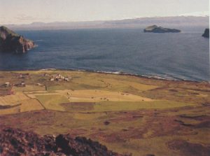
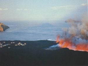
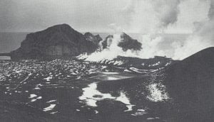
Above left: view from the slopes of Helgafell toward Kirkjubær, the easternmost part of the town on Heimaey, before the eruption, and toward the field where the volcanic fissure opened on January 23, 1973. The beach below Kirkjubær to the east is called Urðir. The Urdir lighthouse stood there. At left on the picture is Yztiklettur and the entrance to the Vestmannaeyjar harbour. At right is Ellidaey island, and in the background the south coast of Iceland, Hekla and Eyjafjalla- jökull. – The photo at above right was taken on the first day of the eruption at the same place as the other picture. Here the fields have become black with volcanic ash, and the fissure extends into the sea. Ellidaey can be seen behind the eruption column at right. All the houses seen on this picture later disappeared under the lava, which is now 100 m thick above Kirkjubær (see p. 382). – The picture at left below was taken in the Kirkjubær area on the first day of the eruption. Crater walls have begun to form along the length of the fissure. In the background are Ellidaey and Bjamarey, behind the eruption column at right. – Below right: The fissure is reaching into the sea at Urdir. The molten lava explodes when suddenly cooled by the sea. – The picture on the page at right shows a view along the fissure on the morning of the first day of the eruption after dawn. The sun is shining on the upper part of the eruption column, but the crater row is in shadow. The edge of the crater in the middle of the fissure is moving to the side under the pressure of the glowing molten lava from the crater bowl. Elliðaey is in the background.
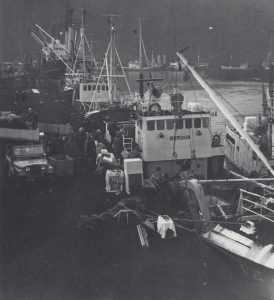
The Vestmannaeyjar harbour was very busy at the beginning of the eruption. Furniture, appliances and other property were shipped to the mainland for storage for the duration of the eruption (picture at left). Above is a view from Helgafell over the mouth of the harbour, Heimaklettur and Yztiklettur on February 19, 1973. Lava had already engulfed the eastern part of the town. From March 18 until April 4, tongues of lava flowed northwest over the town and stopped finally at the fish factory, Fiskiðjun, near the harbour. Below left: The Urðir lighthouse which disappeared under the lava at the very beginning of the eruption. Below right: Lava is flowing over Urðir on its way to the sea.
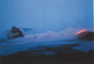
Below, a lava river is on its way down to the sea. It was possible to stand there on the solidifying bridge of lava over the fiery river and take this picture while lava at a temperature of 1200 °C flowed beneath one’s feet.
When the eruption was most intense, glowing chunks of lava flew far into town. Houses caught fire if these ´bombs´came in through the windows. Here at left, a dignified old house is burning on January 28, 1973. Glowing chunks of lava are flying high up into the air and raining down on the site where this picture was taken. When it was at its worst, one could do nothing but place oneself and the camera in safety behind the wall of a house. When first-sized stones landed on one´s helmet, they split open and the molten lava inside could be seen, although the stone had become black on the outside during its long flight in the air.
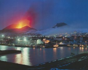
Where there are lights in the houses, people are gathering together their most valuable possessions in order to have them moved to the mainland. The picture above was taken on March 23, 1973, at evening from the slopes of Klifið, above the harbour. Fishing vessels are landing capelin and reduction of the fish is underway, creating profits, even though Eldfell is raining fire over the surroundings. Here the fissure has become shorter, and the eruption has now begun to build up a volcanic cone (Eldfell) at about the centre of the fissure.
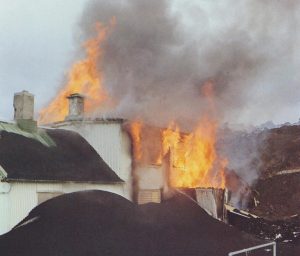
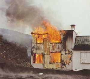
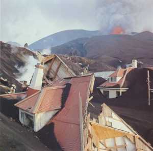
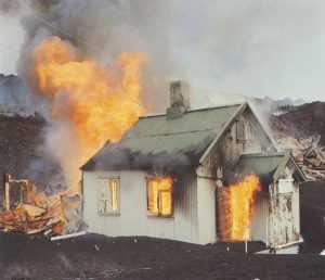
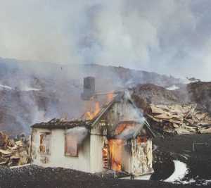
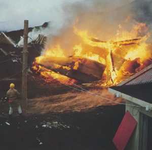
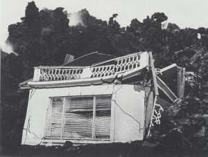
On the evening of March 22, a 300 m broad tongue of molten lava advanced almost 150 m into the town. Then and during the next few days until April 4, about 200 houses were engulfed by lava. On its way, the lava broke down strongly-constructed concrete houses and set wooden houses on fire, and sometimes pushed houses along in front of it. At the top of these two pages are four pictures of the same house, taken from the time it caught fire until it was reduced to a burned-out shell. At left are ruins of houses near the edge of the lava, and at the far right, the lava has ignited one more house ’ near its edge. Electricity was available in the town during the whole eruption. The submarine cable which brought electricity from the mainland was severed during a submarine eruption off Yztaklettur on February 6, 1973, but a 4000 Kw diesel power station in the town generated electricity until it was engulfed by lava on March 25. After that, a small generator in the fish meal factory near the western harbour took over. The large water line from the mainland was severed at the same time as the electrical line, but a smaller pipeline held and continued to supply water to Heimaey.
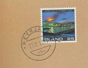
Icelandic stamps often have landscapes as a theme or commemorate events in the history of the land and its people. This stamp marking the eruption in Heimaey in 1973, uses a photo taken by the book’s author on the slopes of Klifid on March 23, 1973. The view shows the harbour, Eldfell and Helgafell.
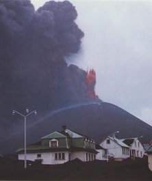
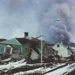
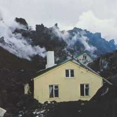
In the photo left, Eldfjell towers over the houses of the town of Vestmannaeyjar. Although volcanic ash had covered part of the town by February 17, 1973, most of these impressive dwelling houses are still undamaged. In the picture below, which was taken of the same houses on March 23, 1973, the edge of the lava field has begun to crush them to ruins. The lava advance first pushed the houses along ahead of it, then broke them up, the heat from the lava sometimes setting them on fire. Middle: the last houses near Skansinn are disappearing under the lava, which is moving forward pushing the houses along in front of it. The picture at right is a view from the town toward Eldfell on January 28, 1973.
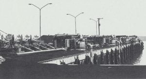
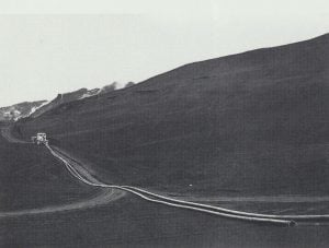
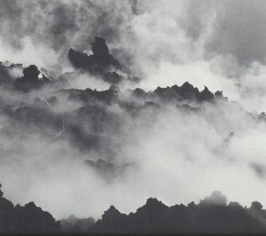
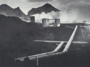
By April 7, 1973 lava had by then engulfed the easternmost part of the town. Early on during the eruption, there were attempts to protect the town by putting up retaining walls of slag and using fire hoses to pump seawater onto the lava advancing toward these walls, in order to cool the lava and slow down its progress. This had some effect, but the volume of water was too small, and it was not possible to pump the cooling water in far enough over the lava. When lava approached the harbour breakwater at the end of February, the sand dredger vessel Sandey was obtained on March 1, to spray water up onto the lava. And then at the end of March, 43 pumps obtained from the US were set up. Their capacity was 800-1000 l/sec, and their lifting height capacity 100 m through 1000 m long pipes. After that, it was possible to cool with seawater farther in behind the front of the lava. During the eruption, a total of 6.2 million tons of seawater were pumped over the lava to cool it, and drilling at five sites subsequently showed that cooling had had a significant effect on the solidification of the lava and therefore slowing its advance. The seawater pumped onto the lava contained about 220 thousand tons of salt. Above are the pumps on Básaskersbryggja in Vestmannaeyjar harbour, and below, a bull-dozer is dragging two lengths of the kind of plastic pipe which proved best for the pumping of seawater into the still moving lava. Above right: seawater is pumped onto the edge of the lava near the entrance to the harbour, and at below right: pipes in the lava and steam clouds from the cooling process.
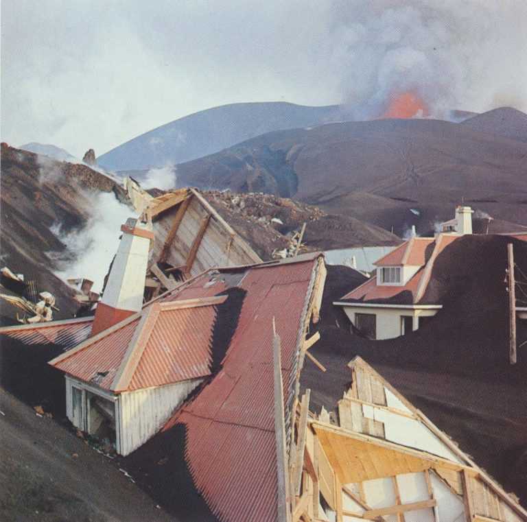
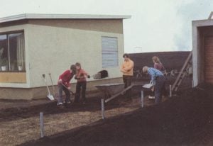
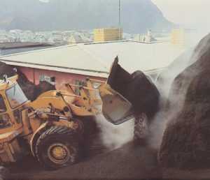
Before the eruption, this flagpole top towered above a family house. Now the knob alone can be seen sticking up out of the black ash. Under these hills and hollows, dwelling houses are buried under a layer of ash many metres thick. Immediately after the end of the eruption, work began on digging the town out and clearing away the ash, except in places which had been covered by lava. Above: Work on digging out the cemetary. The picture at right shows work on digging out houses on Helgafellsbraut. Below right: Helgafellsbraut 21 coming out under boiling hot ash; and below, the whole family works to clear ash from the garden of their home. In the background, there is still smoke coming from Eldfell, and the corrugated steel plates have not yet been removed from the windows which face the volcano. Windows were protected in this way from glowing volcanic ‘bombs’ during the eruption. They set fire to many houses when they flew in through the windows.
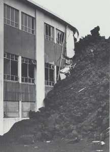
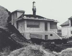
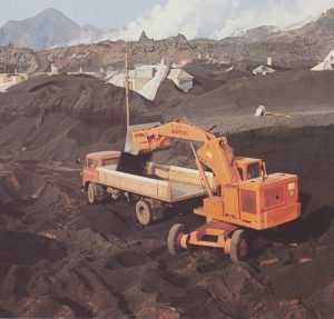
The photo at above left shows how the lava stopped and piled up against the fish factory building Fiskiðjan on Strandvegur down at the harbour, breaking up part of the building. This lava was later removed from Strandvegur. Below left: parts of a house which the lava had torn down and pushed ahead of itself. At right is a view of an ash-covered section of Vestmannaeyjar. Only the chimneys of the houses are visible above the ash. Above is a picture of the house in the foreground of the picture at right, after the house has been mostly dug out of the ash. Below: part of the new district heating system which utilizes the heat of the new lava. The system pumps water heated up by the lava through a closed pipe system, delivering the heat to the houses in town. In the lava the pipes are laid on the surface of the solidified, but still warm lava, the pipes being insulated on top by volcanic ash. It is estimated that the heat contained in the lava is sufficient to meet the heating requirements of Vestmannaeyjar town for 15-20 years.
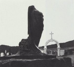
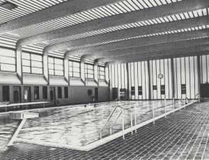
‘I live and you shall live’ stands on the gate to the churchyard in Vestmannaeyjar. These words were in many peoples’ minds while Eldfell spewed ash and glowing lava over the town, as seen in the photo at left. Eldfell is erupting in the background, and the graves in the churchyard are covered with black ash. But the words on the gate proved to be true. Above the churchyard has been cleaned up, and Einar Jónsson’s sculpture, ‘Alda aldanna’ (The eternal wave’) has been set up west of the cemetary. Below is the new Vestmannaeyjar swimming hall, which was built with donations after the eruption. It replaces the swimming pool at Skansinn, which was covered by lava.
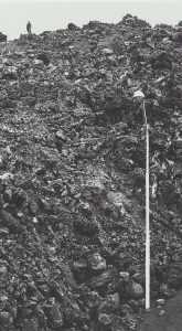
Certainly this picture may look unreal. The lava-front has stopped at the edge of the sidewalk. The houses along the street have been engulfed by the lava, but the light-post is still standing at the roadside, in solitude, and apparently without any purpose, except possibly as a reminder that houses once stood here – the homes of industrious Westman-islanders, until early one morning when a rift opened on the island, and started to spew fire and ash.
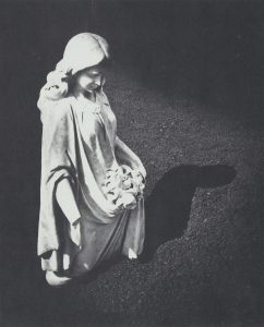
This statue of an angel stands at a grave in the Vestmannaeyjar cemetary. Ash came up to the figure’s knees before clean-up work began. On the picture at right, taken at the end of the clean-up work in the churchyard, it can be seen how thick the layer of ash had been on this spot. The angel stands over the grave of Theodora Þ. Jónsdóttir from Gardur in Vestmannaeyjar, who died at the age of 22 (born 26 December, 1906, died 16 May, 1928), daughter of Jón Henriksson and Ingibjörg M. Theodorsdóttir from Gardur, who are also buried in the same plot. In the background is the church Landakirkja.
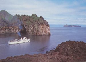
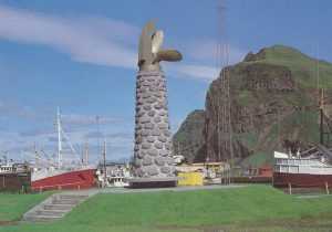
The eruption changed the Vestmannaeyjar harbour a great deal, and in fact, made it better. The entrance is now like a fjord, and the breakwaters which formerly protected the harbour from the worst waves, are now themselves sheltered from all seas. It is believed that the efforts to cool the lava played an important part in preventing it from closing the harbour altogether. The picture at left is taken in the new lava across from Heimaklettur. The Herjólfur, the ferry between Þorlákshöfn and Vestmannaeyjar is on the way out of the harbour, in the background is Klifið. Sandy coves and armlets have formed between lava headlands in the new lava. Above, the Herjólfur sailing out through the new harbour mouth between Yztiklettur and the new lava with Elliðaey in the background. – Below right is the Þór monument, erected after the eruption in memory of the first Vestmannaeyjar rescue ship and patrol boat. The monument is located in near Friðarhöfn harbour below Klifið. In the background are fishing vessels in Friðarhöfn and Heimaklettur.
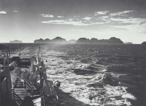
The Vestmannaeyjar rise abruptly out of the ocean. Farthest east (here at left) are Elliðaey and Bjarnarey. Then come Yztiklettur and Heimaklettur. Helgafell is visable over Eiðið, and to the right of that areKlifið and some of the outer islands.
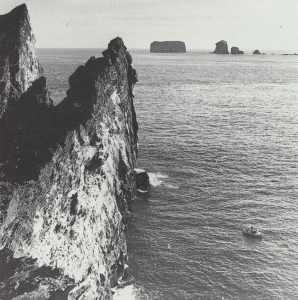
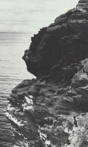
Heimaey is the only one of 15 islands in the Vestmannaeyjar group which has ever been inhabited. There are about 30 reefs and pillars of rock in addition to the islands. The Úteyjar or ‘outer islands,’ as all of the islands except for Heimaey are called, are a world unto themselves. They all have steep cliffs plunging into the sea and are built up of tuff from many eruptions. The Úteyjar are mostly grass-covered at the top, although some are very steep. People from Vestmannaeyjar have always gathered eggs and caught sea birds especially the Puffin for food, and this is still the case. In the larger of the outer islands, there are many hunters’cottages and huts, and there are often quite a few people there in summer. For some of the islands a still day must be choosen to land, and after landing on a cliff platform or a ledge, it is often necessary to climb sheer tuff cliffs to get to the top of the island. In many places there are aids to climbing – ropes or chains and bolts in the tuff – which make the ascent much easier. At left is a picture from Hellisey. The landing place is lowest left. There is a path from there over sloping tuff ledges up to the hut, which is higher up to the right. Two men are on the way up in this photo. In the background are the islands Brandur and Álfsey. – Above is the view from Hellisey to Súlnasker (at left) and Geldungur (right). An inflatable rubber boat is visiting at Hellisey. The rock-ledge below the cliff is another landing site and the path up to Hellisey goes from there behind the steep cliff in the foreground. The picture at right was taken on Elliðaey. The men on the ropes are gathering eggs from the cliffs.
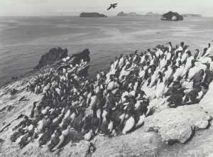
This picture shows a guillemot colony at the top of Geldungur. Guillenjot and the ‘bridled’ guillemot (a variety of guillemot) cover the top of Geldungur so densely that it is almost impossible to make one’s way through the area. The birds are quite tame here, as they are seldom visited by men, because of the difficult climb (see top on next page). In the background are the islands Álfsey and Brandur at left and then at right Heimaey and Hellisey, behind which is Sudurey.
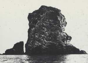
The picture above shows the ‘path’ up onto Geldungur. The picture at left was taken up there. The landing site is at the spur of rock at right in the picture above. From there, there is a series of ledges in the cliff which lead up to the ledge where the man is standing. It is impossible to carry anything when climbing this route, and all baggage and provisions are hauled up from the boat on a lipe. – Below is a puffin in the outer islands. It is a colourful and interesting bird but looks clumsy in flight. Puffin-hunting and egg-gathering were formerly very important economically in Vestmannaeyjar. Men lowered on ropes harvested mainly guillemot eggs from the cliffs. Puffin-hunting is still popular today. The season is 4-5 weeks long, from luly into August. The puffin is eaten, but hunting is now seen more as a sport than as food-gathering. Many who hunt on the Úteyjar year after year consider their weeks there the most relaxing of the year, as they can live without regard to the time of day or night and enjoy the outdoor life. For most of them hunting is secondary.
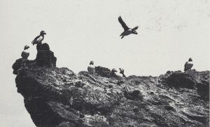
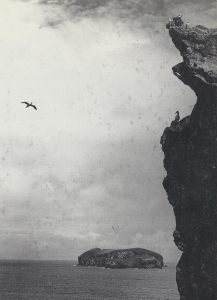
Above is a gannet (hafsúla) in flight and on the cliffs of Hellisey. Highest up on the brink are several puffin. The gannet is a majestic bird, often called the queen of the Atlantic. It nests on Eldey offReykja- nes (seep. 158) as well as on four of the outer islands of the Vestmannaeyjar group. In the background is the island Brandur, in same direction as Álfsey from Hellisey.
The main national festival to commemorate the 1000th anniversary of the settlement of the country by the Nordic peoples was held at Þingvellir in 1874. King Christian IX visited Iceland and formally handed over the new constitution. There were local celebrations all over the country for those who could not travel to Þingvellir. The national festival for Vestmannaeyjar was held on August 2, 1874 in HerjólfsdaT ur. It was heavily attended as it had not been possible to travel to the mainland because of bad weather. – It is said that Herjólfur Bárðarson, the first settler of the Vestmannaeyjar, built his farm in Herjólfsdalur. The valley is part of an ancient crater which the sea has broken open to the south. It is encircled by cliffs, the edge of the crater, on three sides, and there are rock slides and green slopes below. There is a pond at the bottom of the crater in the middle of the valley. There were about 400 people gathered there at noon on August 2, 1874. Tents had been raised, and the so-called Herjólfsdys (cairn) was decorated with flags. When people had eaten and drunk coffee, some of the festival guests began to dance, and others sang in chorus. People stayed until about midnight having fun and enjoying the excellent weather. – The national festival in Herjólfsdalur in 1874 had been so successful that one has been held there every summer since. The athletic clubs Þór and Týr take turns organizing the event. The festival now lasts for three days in the green mountain dale of Herjólfsdalur. The town’s residents move out here in the first days of August. A whole town of tents is raised. They stand close together along pedestrian streets which have been laid out in advance. Tents are equipped with furniture – tables, chairs, benches and cupboards. Families eat there between amusements and visit neighbours. The whole valley is beautifully decorated and the lights in the evening are impressive. The sound of instrumental music and choral singing floats about the valley, echoing from the cliffs, and plays are performed and dances held. – One of the most impressive events at the festival is always the descent by skilled climbers from the edge of the cliff Fiskhellanef. They swing back and forth against the cliff on their way down into Herjólfsdalur (picture at left). At midnight on the first day of the festival, a huge bonfire is lit on Fjósaklettur in Herjólfsdalur, and a red glow plays on all the green expanses, around the edges of the crater, and on the tents and the crowd in the valley. The final event of the national festival is the great fireworks display which lends a fairy-tale atmosphere to Herjólfsdalur, this unique area for a celebration at the bottom of an ancient crater. Aeons ago volcanic fires threw glowing lava masses high into the air here, thousands of years before human habitation began in Iceland. Now people enjoy the beauty of fireworks, though most festival guests have vivid memories of the frightening fireworks of Eldfell a few years ago, the fires which had such fateful consequences for Vestmannaeyjar.


