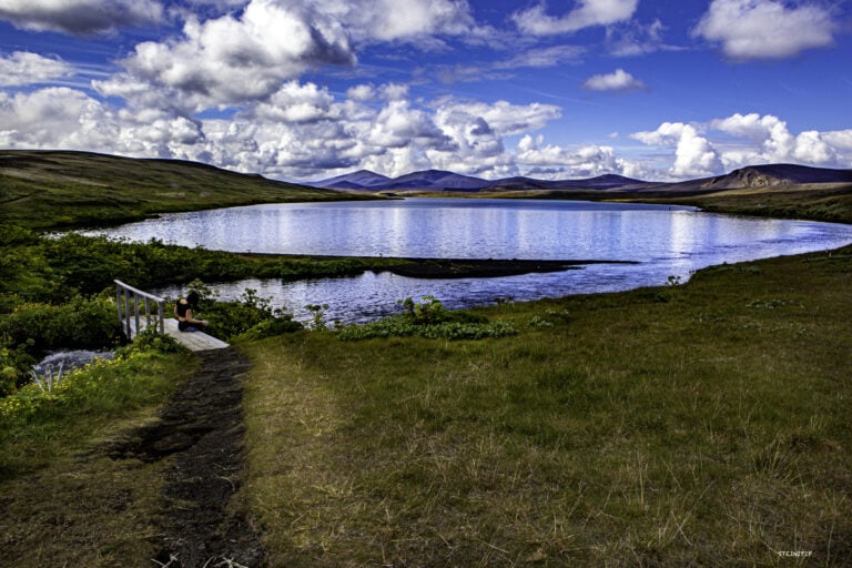
This photo was taken last weekend by Veiðivötn, a cluster of lakes in Landmannaafrétt that consists of up to 50 lakes. All the lakes have been given their names; the one in the photo is Langavatn. Slýdráttur is the area where the picture is taken, and the water’s edge is at the front of the lake.
Vatnaöldur rise in the background of the photo. They are special because when the first settlers settled here, a 10-kilometre-long fissure eruption was ending. They later got the name Vatnaöldur. The two-tone tephra layer called the “settlement layer” was formed during this eruption. It is two-toned because the eruption happened at the same time as another large one in the Torfajökull Glacier Volcanic System.
It has happened more than once that Veiðivötn and Torfajökull erupt simultaneously. There was considerable ash fall all over the country, except in the Westfjords, and probably caused damage to grassy fields in many places.
There was considerably more ashfall from the eruption than lava flow because the area has much groundwater. When the magma came into contact with the water, it exploded.
It is not clear exactly when this eruption began, but it was very close to the year 870. It may have been the first volcanic eruption witnessed by the settlers and was not over when the first arrived in the country.
The settlement layer has proved particularly useful in timing other geological events and has also come in handy for archaeologists. This is because it is relatively easily identifiable in the seismic profile, and the tephra, as mentioned before, spread very widely.
If you, dear reader, are interested in exploring one of the country’s most magnificent places, then take a person who knows the place and the area well.
Photo and text: Steinipip
