It really surprises you that Grindavík’s coat of arms is a foreign goat. Most of the natural riches in this area are drawn from the sea, but not from the barren land, and it has always been that way. The people there had to pick natural herbs and collect grass to feed themselves and their animals in ancient times but their livelihood mostly came from the sea. It would have made more sense to put the pilot whale or porpoise on the coat of arms, because the name Grindavík is undoubtedly a reference to pilot whales that may have washed up on the shores in the area. It comes to mind that pilot whales may have come up to, or washed up on these wide and extensive beaches that lie southwest of the town, where you have Malarendar, Litlabót and Stórabót.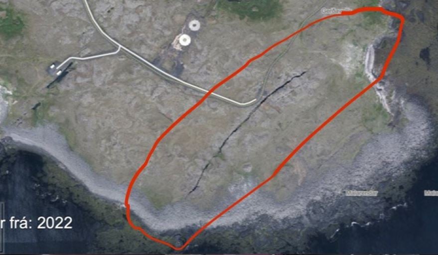 In this area, near Gerðavellir, there is one large fissure, which is in a SW direction and is undoubtedly a continuation to the fissures and sickles that have been discussed in the news in the northwestern part of the town of Grindavík (see the previous picture), Malarendar. This is clearly obvious in the photo that adorns the front of the homepage of the town of Grindavík on the Internet. About 500 m to the west is another parallel crack, which leads out to sea where Bergsendi and Klaufir are (see the second picture).
The person writing this article does not have access to this evacuated area for exploration, but hopefully other researchers with the permission of the authorities will be able to enter these areas to explore the southernmost parts of Grindavík’s sickle and fissure systems. It is precisely here that magma is most likely to flow out of the lava tunnel and into the sea.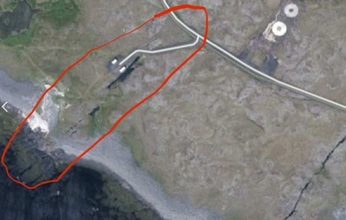 Text: Haraldur Sigurðsson
Dr. Haraldur Sigurðsson volcanologist and geochemist
