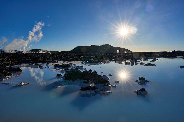
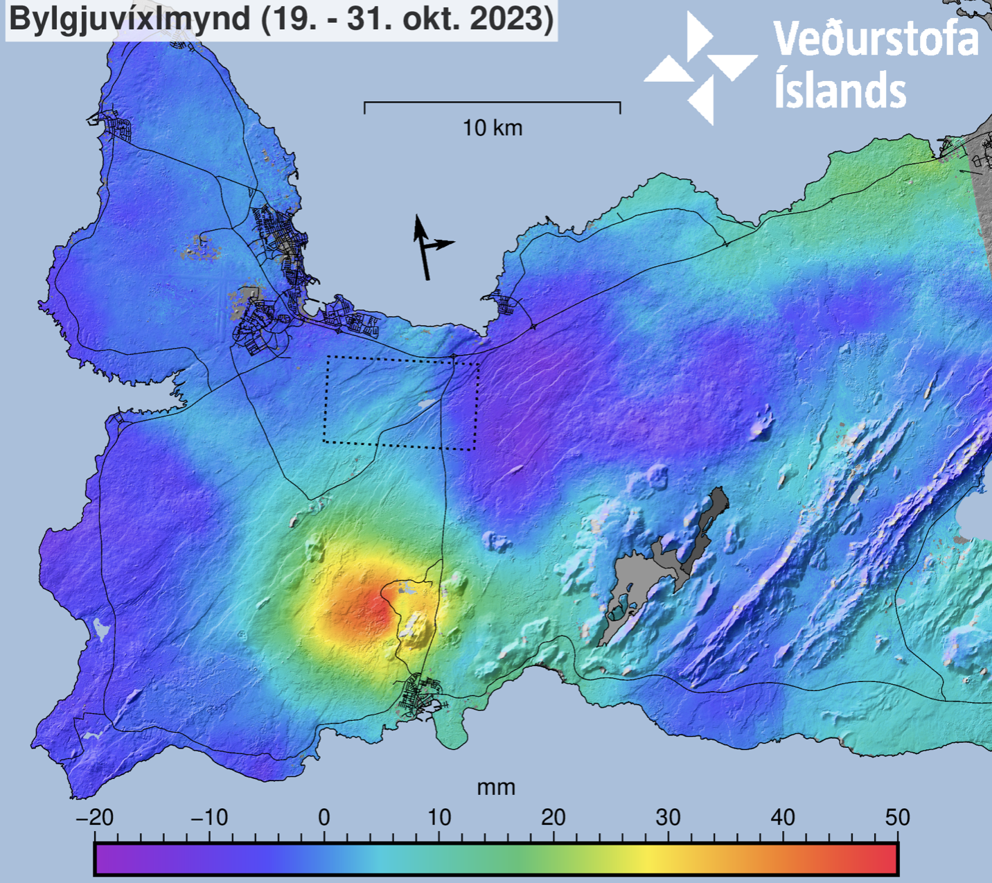
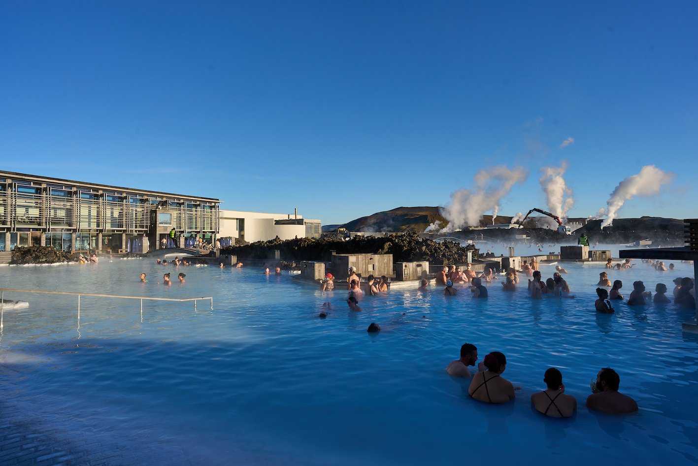
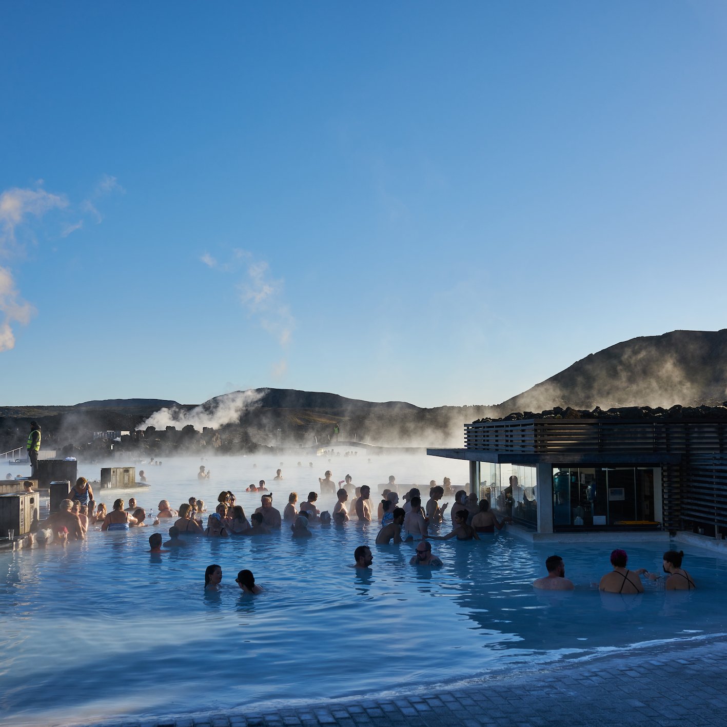
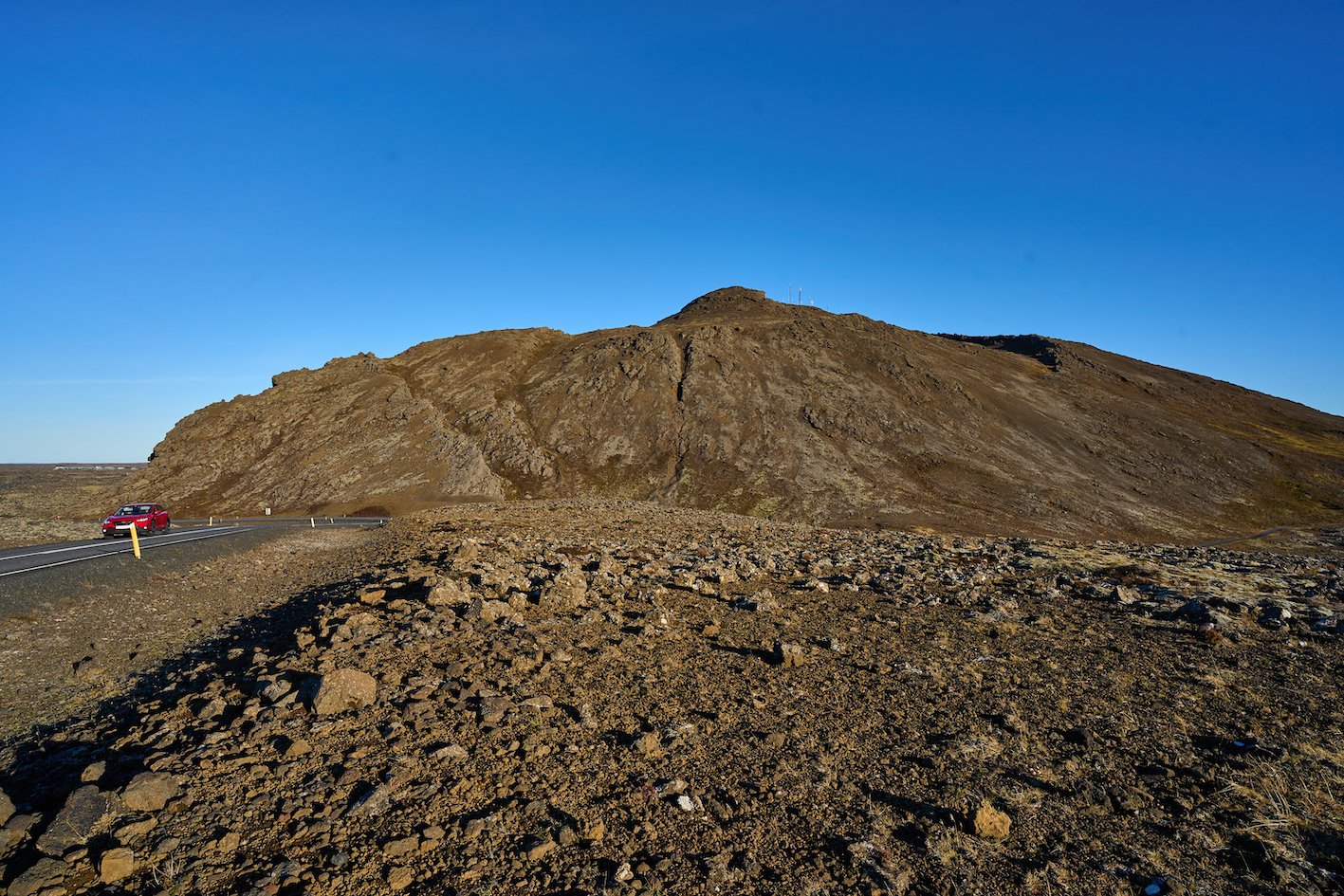
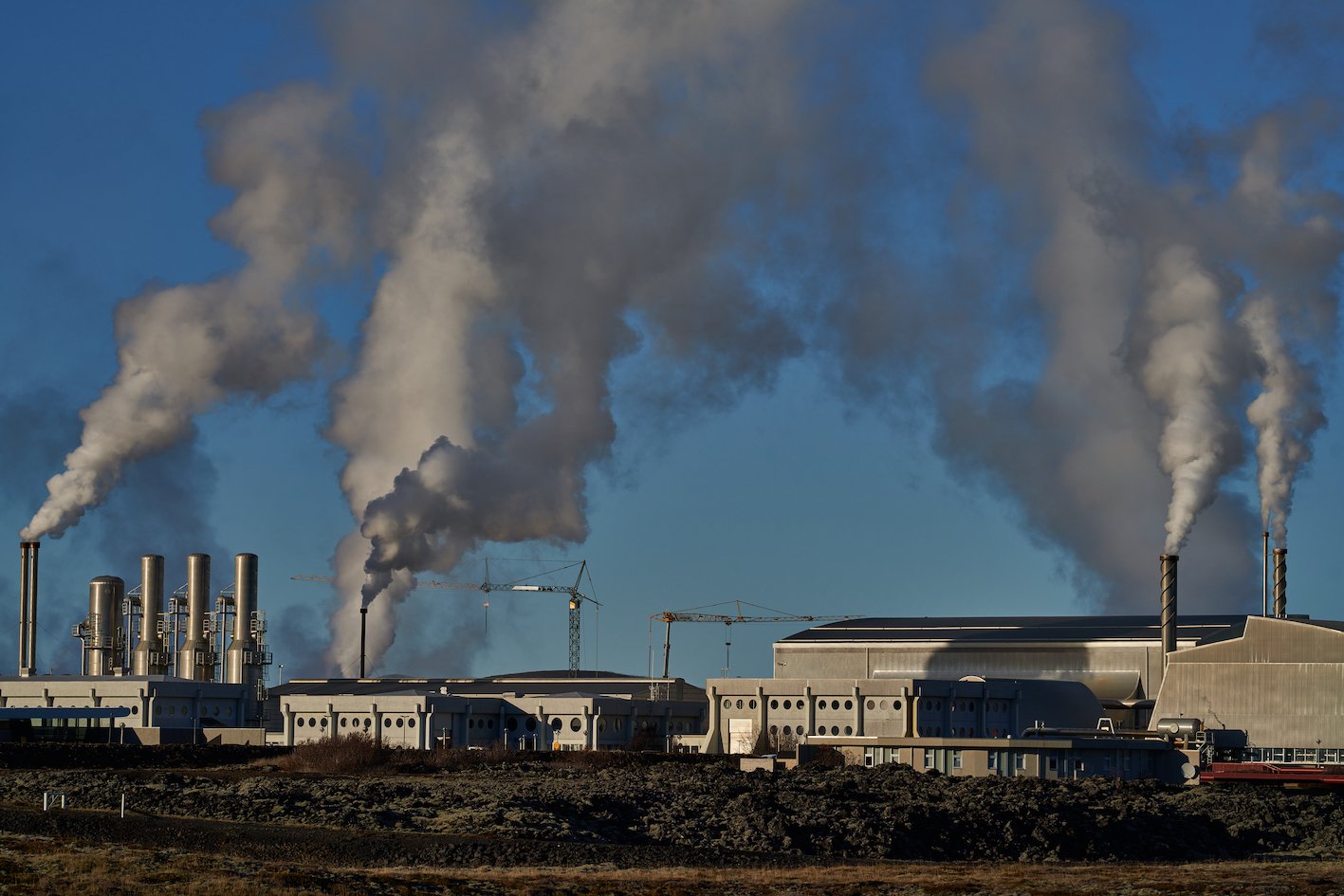
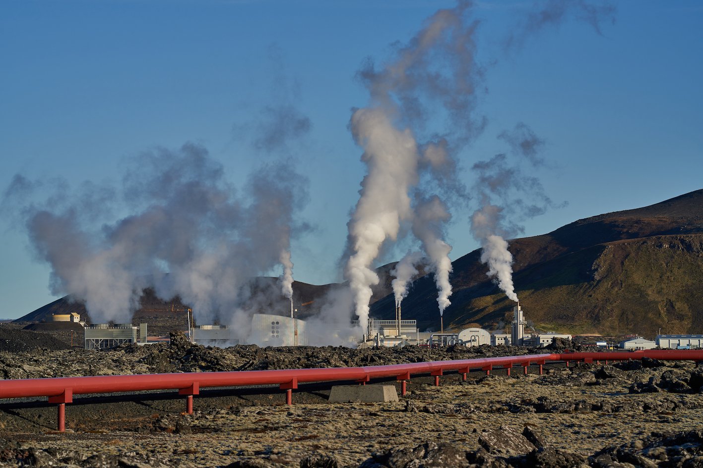
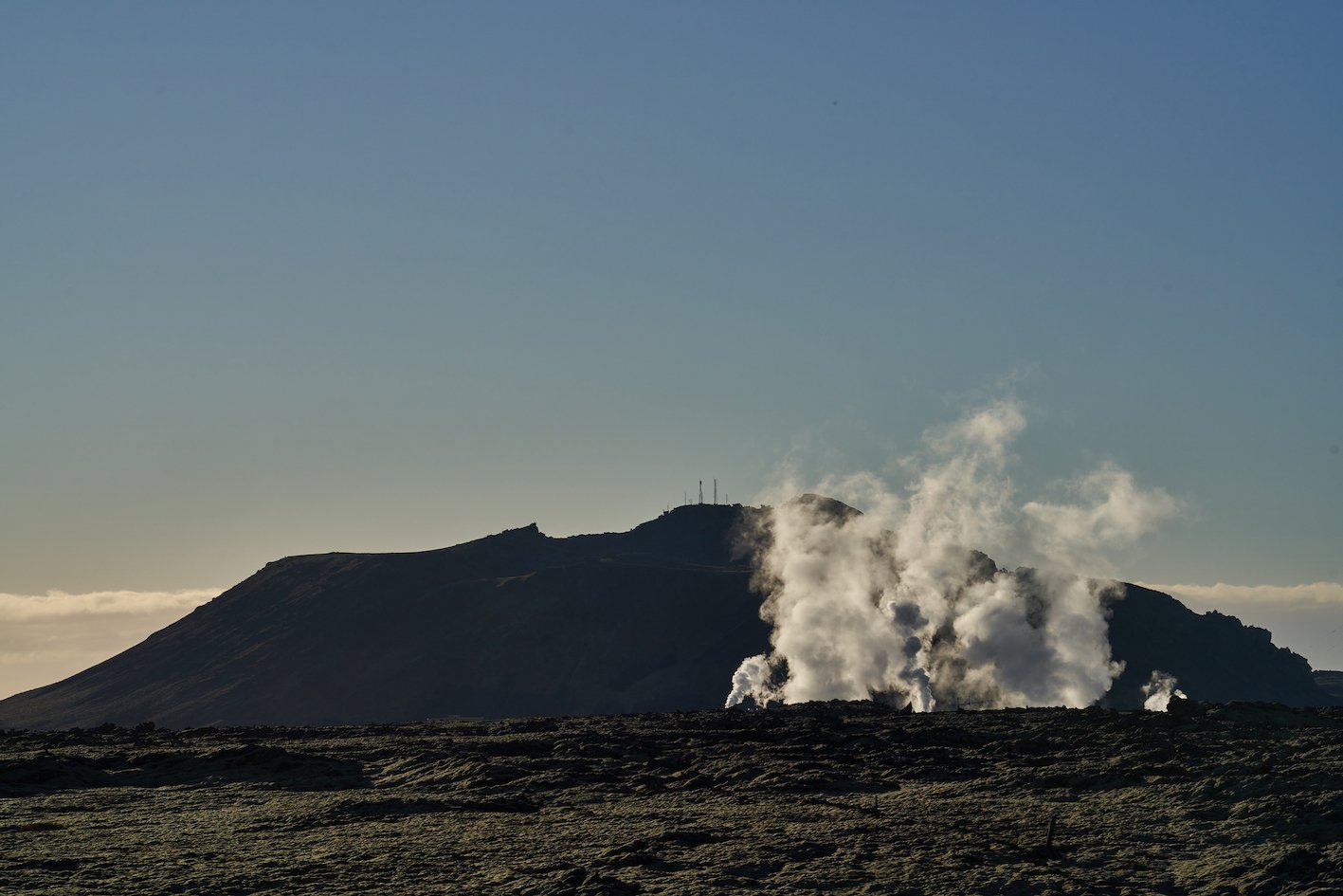
The Icelandic Meteorological Office not only makes weather forecasts and does the aviation weather services for Iceland and the sea area around the country, but the agency monitors the risk of volcanic eruptions, earthquakes, avalanches, floods, mudslides, runoffs, sea floods and sea ice spread, and sends out warnings and information to the Department of Civil Protection and Emergency Management, the public and the government. These days, an incredible number of earthquakes and magma movements are being observed very closely to the capital in the area around the mountain Þorbjörn, which stands between Grindavík and the Blue Lagoon. But the distance between the places is only 3 km. The land has been rising there (see map from the Icelandic Meteorological Office) and the glowing hot lava magma is only about 4 km deep northwest of Þorbjörn. There, in the middle of a lava field, the Blue Lagoon is located, one of the most popular tourist attractions in Iceland, which is visited by hundreds of thousands of visitors every year. But more seriously, right next to the Blue Lagoon is Svartsengisvirkjun, a geothermal power plant that provides over 30 thousand inhabitants of Reykjanes with hot water, as well as electricity. If the power plant were to get destroyed, it would be very bad indeed, but the power plant and the Blue Lagoon stand in Illahraun lava field, which flowed in 1226. Similarly, Grindavík is still one of the most powerful fishing towns in the country, with an excellent harbor for even the largest fishing vessels in the Icelandic fleet. Iceland’s Meteorological Agency says that if there was to be an eruption, it would come with only a few hours warning, so that people could barely get away from the area before the eruption begins and so it has been evacuated for now. The Icelandic Times took a look at the area around Þorbjörn, where everything is moving and shaking these days with the inhabitants living in uncomfortable uncertainty.

Photographs & text: Páll Stefánsson
Illahraun 01/11/2023 – A7C, A7R IV, RX1R II : 2.0/35mm Z, FE 1.8/135mm GM, FE 1.8/20mm G
