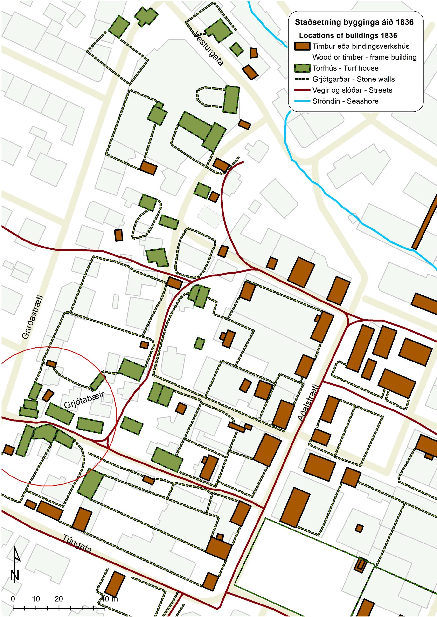
Grjótaþorp
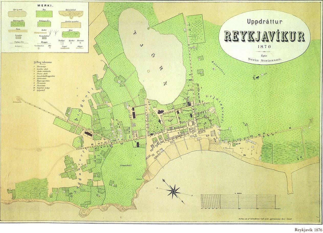
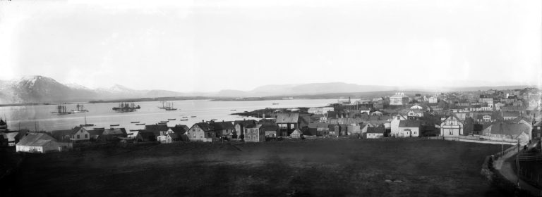
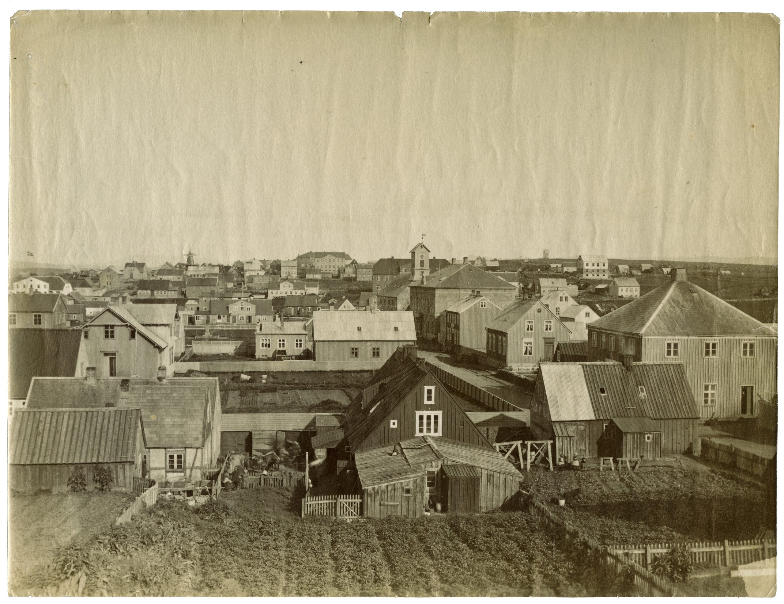
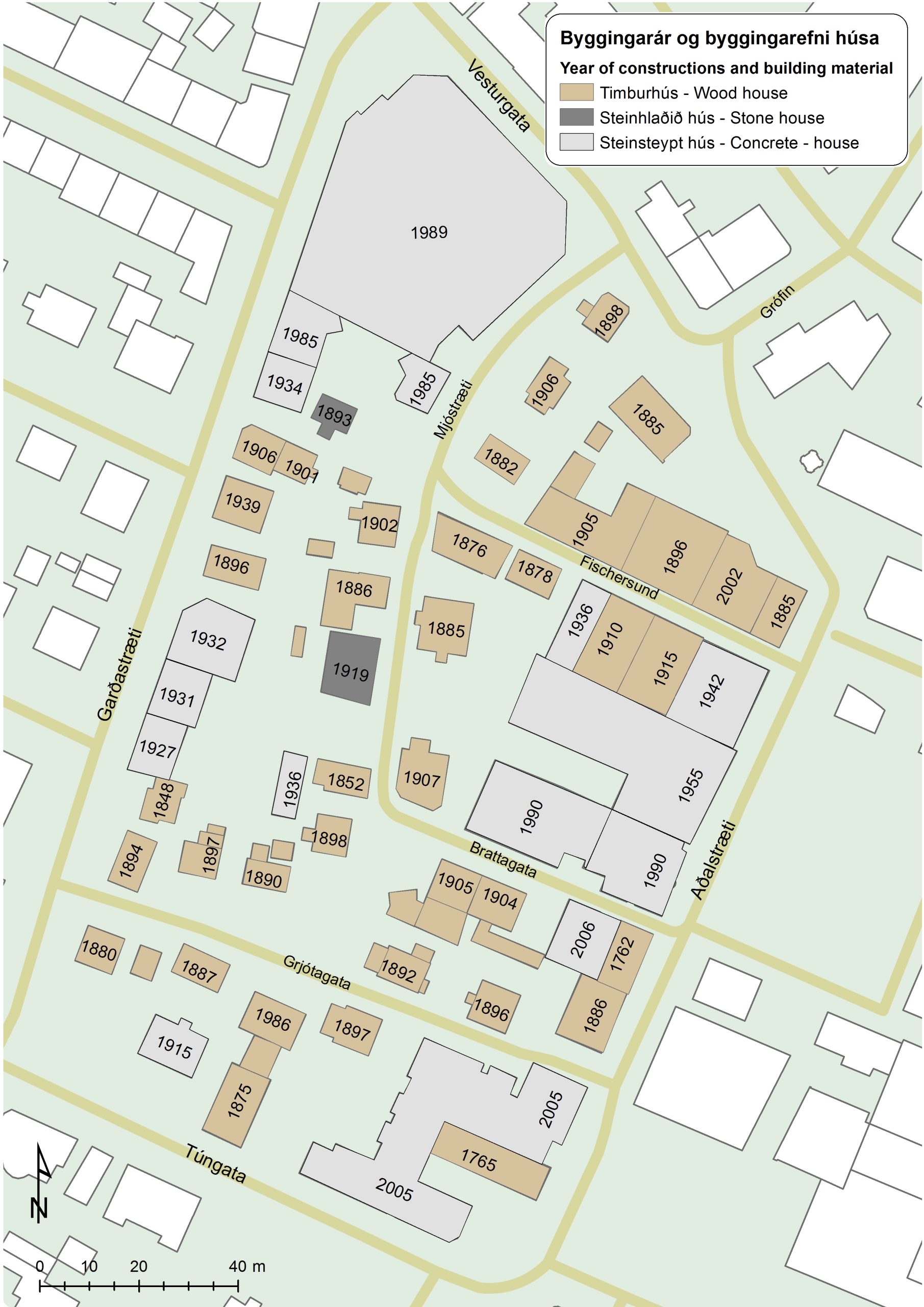
Grjótaþorp (Grjóti Village) derives its name from Grjóti, one of eight smallholdings on the estate of Reykjavík in the 18th century. The farmstead stood here on Grjótabrekka (Grjóti Slope) at the top of Grjótagata. In the latter half of the 18th century, when wooden buildings were being constructed on Aðalstræti, a cluster of turf houses grew up on the Grjóti property. The turf homes housed landless labourers and fishermen, and staff of the Innréttingar (the New Enterprises, woollens production on an industrial scale intended to propel Iceland into the modern age). The first merchant in Reykjavík, Johan Chr. Sünckenberg, built his commercial premises on Aðalstræti in 1780, after the trading post was moved from offshore Örfirisey to Reykjavík. The warehouses were on adjacent Vesturgata. Grjóti was aptly named (from grjót =rock), and its rocky fields stretched down the hill towards Grófin. In 1790 the rocks were cleared from the grassfield, and used in building Reykjavík Cathedral on nearby Austurvöllur. After that the inhabitants started to make gardens on the land. In 1802, 19 houses in Grjótaþorp were inhabited by 141 people. About 20 turf houses remained in Grjótaþorp in 1836, after which they were gradually replaced by wooden buildings. By 1900 no turf houses remained.
Grjótaþorp is delimited by Aðalstræti, Vesturgata, Túngata and Garðastræti.
Aðalstræti (Main Street) is the oldest street in Reykjavík, previously known by Danish names Hovedgaden and then Klubgaden. It originated as the path from the farm of Reykjavík to the seashore. The textile workshops of the New Enterprises were located at the southern end of the street, and commercial premises at the north end. Vesturgata (West Street) was previously known as Hlíðarhúsastígur (Hlíðarhús Path) and Læknisgata (Doctor‘s Street): it was the westward route out of town towards the estate of Hlíðarhús and Seltjarnarnes, where the Chief Medical Officer resided. Túngata, previously Landakotsstígur (Landakot Path), led westwards from Aðalstræti to Götuhús and Landakot, which were smallholdings on the Reykjavík estate. The name of Túngata (Grassfield Street) refers to grassfields through which the road led: Ullarstofutún, Götuhúsatún and Landakotstún. Garðastræti (Wall Street) was named after an old rock wall on the boundary of the Grjóti and Götuhús estates. Fischersund, formerly Götuhúsastígur (Götuhús Path) led from Aðalstræti westwards to Götuhús. It was renamed Fischersund (Fischer Alley) in honour of merchant Waldemar Fischer, who founded a charitable fund in 1888 to aid poor widows, fatherless children and needy young people in Reykjavík and Keflavík. This is the only street in Reykjavík named after a Danish merchant. Mjóstræti (Narrow Street) was once known as Brekkustígur (Brekka Path) after a turf house, Brekka, which stood on the site of the present Vinaminni, Mjóstræti 3.
Grjótaþorp fell into a state of dilapidation in the 20th century, due to plans for building a major road through it. That idea was ultimately abandoned, and today all the old wooden houses have been renovated; in addition a number of wooden buildings from other districts have been rebuilt in Grjótaþorp, consolidating the old street plan. Grjótaþorp, one of the oldest extant quarters of wooden buildings in Reykjavík, is characterised by narrow streets with detached wooden houses in small, well-tended gardens.
Historical markers in Reykjavík
In recent years the City of Reykjavík has been installing historical markers around the city. Such markers at historic sites and areas within Reykjavík enrich the experience of both residents and visitors, and provide information on the city‘s culture and history. The markers display information about history, art, literature and social life relating to the site in question, accompanied by pictures.
Text and photos: Reykjavík City Museum
See further at www.reykjavikcitymuseum.is
